High water: How design might help fix the Wheatbelt’s water woes
Agricultural land in one of Australia’s most important rural economies is trapped in a cycle of continuous degeneration. Could the implementation of a more carefully designed and planned landscape ecology prevent catastrophe?
Growing up on a broadacre cropping farm water was always central to my family’s life and livelihood. My childhood was spent leaning on the western fence, holding my breath and crossing my fingers that the front rolling in from the North West would make it as far as our place at the foot of the Wongan Hills. Now a practising landscape architect in Fremantle, I can’t seem to shake the habit. I still scan the horizon for an impending front, and take note of wind direction. My UDLA colleagues call me “the weather girl”.
Although always close to the environment around me, my childhood perspective was one of intimate, subjective knowledge of place. Studying landscape architecture taught me to think objectively. I began to see through the landscape I had always known and loved, to the underlying problems below. I began to question our farming practices and processes, and came to the realisation that not only was the land sick, it was stuck in a cycle of continuous degeneration. This realisation unfortunately came too late: the farm had by then become unviable, and we sold up in my final year at university. Nevertheless, it led to an honours thesis entitled Ameliorating Agriculture, Cultivating Biodiversity, which subsequently became the impetus for a field trip I recently completed along the Gondwana Link as part of a travel scholarship.
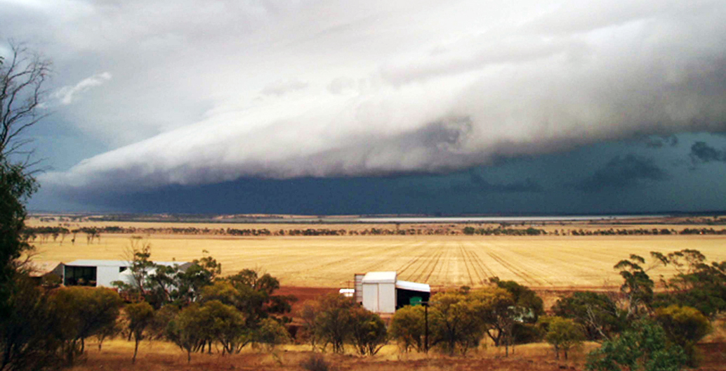
A summer storm in Western Australia's Wheatbelt
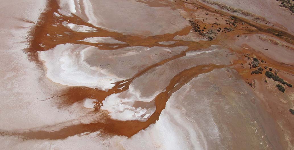
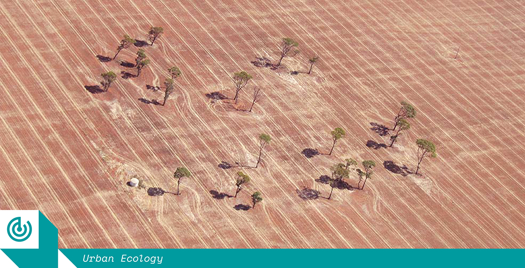
Seen here from the air, soil erosion, salinity and nutrient leaching, which afflict many Western Australian farms.
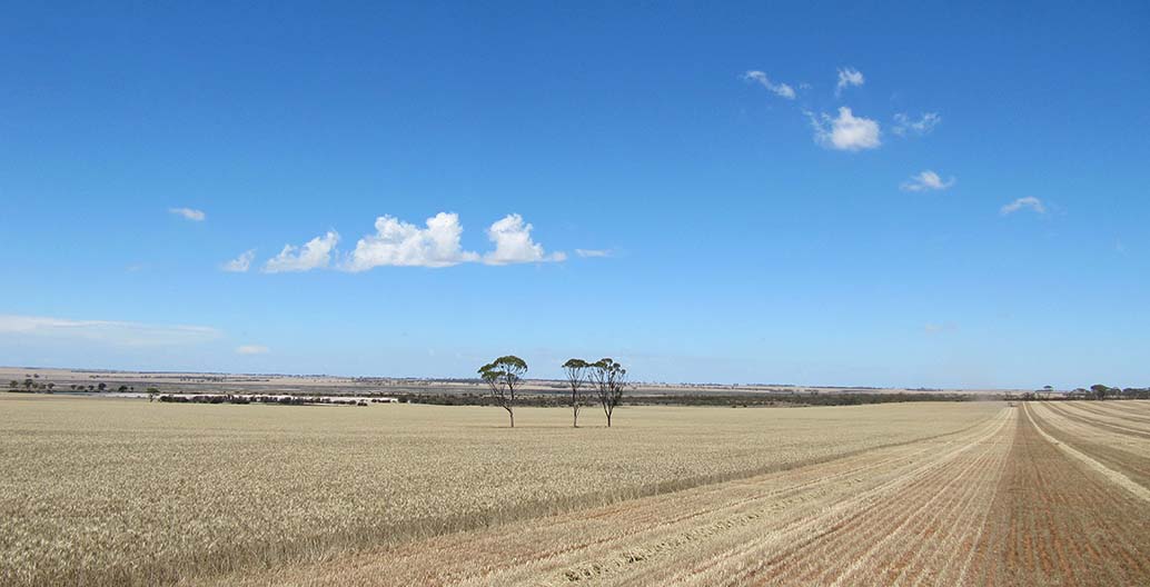
A wheat crop in Western Australia under harvest.
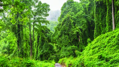
The Gondwana Link in Western Australia’s South West is an ambitious project that aims to link ecosystems across 1000 kilometres of southern Western Australia, from the high rainfall forests of the west coast to the arid woodlands bordering the Nullarbor Plain. Those involved in the project are collectively tackling large scale land degradation, such as salinity, loss of biodiversity and habitat fragmentation, while providing site specific solutions to improve the health and resilience of ecosystems. Fifteen years in, it is one of the largest and most ambitious conservation projects in Australia.
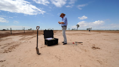
Traveling along the Gondwana Link, I visited farmers, botanists and environmentalists, to discuss how they were tackling similar problems to those being faced all throughout Western Australia’s Wheatbelt. Water was often in the foreground of our conversations. From drought to flooding, and from frost or unseasonal storms, water is the primary key to sustaining farming life, while also holding the most power to wreak destruction.
The Wheatbelt’s water challenges are linked to those being faced in Perth, for while its broadacre agriculture relies on natural rainfall rather than irrigation, its drinking water is piped from Perth. This water is pumped from the same aquifer that provides both Perth’s drinking water and surface water for the city’s horticulture. This draining of the aquifer is happening at a rate that could be unsustainable in the long term.
With 85% of Perth’s water coming from groundwater and plans to expand its already unsustainable use, the aquifer could become terminally low or saline; this would lead to terrible results for both people and the environment. For this reason, it is vital that communities in the Wheatbelt become self-sufficient in all water needs, to ensure the long-term viability of both farms, the rural communities and the cities they feed.
Large-scale land-clearing devastates water systems
Nearly all environmental problems associated with the degeneration of our agricultural land and ecological systems in the Western Australian Wheatbelt, including water loss, stem from one key source: large scale erasure of vegetation. Initiated by the state government just after the First World War and continued through to the 1980s, almost 90 percent of endemic vegetation in the Wheatbelt was razed to the ground to make way for agricultural expansion. The wide-scale removal of ancient deep rooted trees, to be replaced by shallow rooted annual cereal crops, resulted in a rise in the water table. This dissolved naturally occurring salts throughout the soil profile and deposited them on the surface, causing widespread salinity.
Sheep and cropping systems further degraded the land, compacting the topsoil and causing wind and water erosion. While small contour banks were erected to direct the runoff as it sluiced across the paddock, the paddocks had become water repellent due to compaction. Other linked ecological issues include the loss of diversity and extinction of flora and fauna, the erasure and fragmentation of remaining bushland, and the fragmentation of specific habitats. These ecological systems had evolved over hundreds of thousands of years to create an equilibrium: a balance between resources that a century of broadacre agriculture has thrown completely off-kilter.
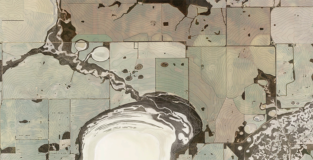
Remnant vegetation mapping.
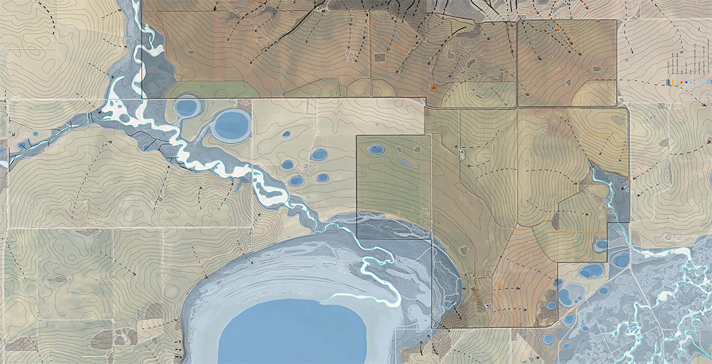
Hydrology analysis.
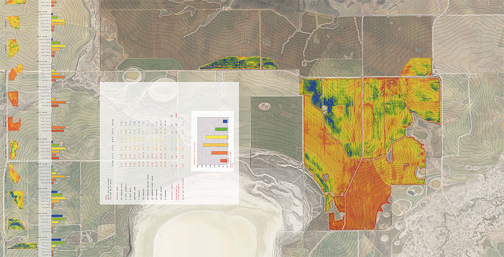
A map describing farm yield.
The net effect of all this change is a highly volatile environment for farming, which already involves a precarious guessing game, marrying weather estimates and investment to achieve a margin that allows a farmer to do it all again the next year. The surging cost of investment inputs, such as fuel and synthetic fertiliser, coupled with low grain prices and increasingly erratic and unpredictable rainfall events, are tightening that margin.
The farming economy revolves around efficiency: achieving the highest yield with the least input. To stay viable within current agricultural conditions, farmers need to increase the area of land farmed, to generate greater efficiency. Technology is evolving to support this expansion, with the size of machinery increasing to service larger farms, equipped with technology to map and monitor yields, and customise inputs accordingly. This increase in scale is having an adverse effect on rural communities, with a net reduction in employment pushing the workforce off the land and into the cities.
The landscape is also suffering, as both fence lines and single paddock trees are cleared to facilitate the movement of larger machinery, removing important habitat. The application of synthetic fertiliser is causing acidification of soil, while regular herbicide application has led to herbicide resistance in many weed species. Wide expanses of bare paddocks are stripped of their top soil during summer’s strong easterly winds. So, while current practices are designed to be more efficient, they are also accelerating the degradation of the environment.
Keeping water “high in the landscape”
In acknowledging that my original research in this area was driven by an ambition to redesign the way the family farm worked, from a degenerative system into regenerative one, the sale of the farm meant shifting focus. I reframed my research to investigate farming practices at a regional and catchment scale throughout the Wheatbelt. With this, my research started to look at emerging precision agriculture, including water use efficiency yield mapping, and controlled traffic farming. Could such technology-driven efficiencies be integrated into environmental and ecological system design, to establish a regenerative synergy between agricultural and ecological landscapes?
Put simply, precision agriculture aims to improve a farmer’s ability to manage variables within a paddock. It provides tools to quantify soil, terrain and crop variability, allowing farmers to customise agronomic applications and practices to better suit these variables. Water use efficiency yield mapping is a method of measuring how efficiently a crop has yielded with regard to the amount of rain that fell in the associated growing season. Rather than comparing the yield of one year to the next, in which the total rainfall always varies, this method projects a maximum yield which could be achieved for that season’s rainfall, allowing for a base line for input improvement and refinement.
A wheat crop in Western Australia under harvest.
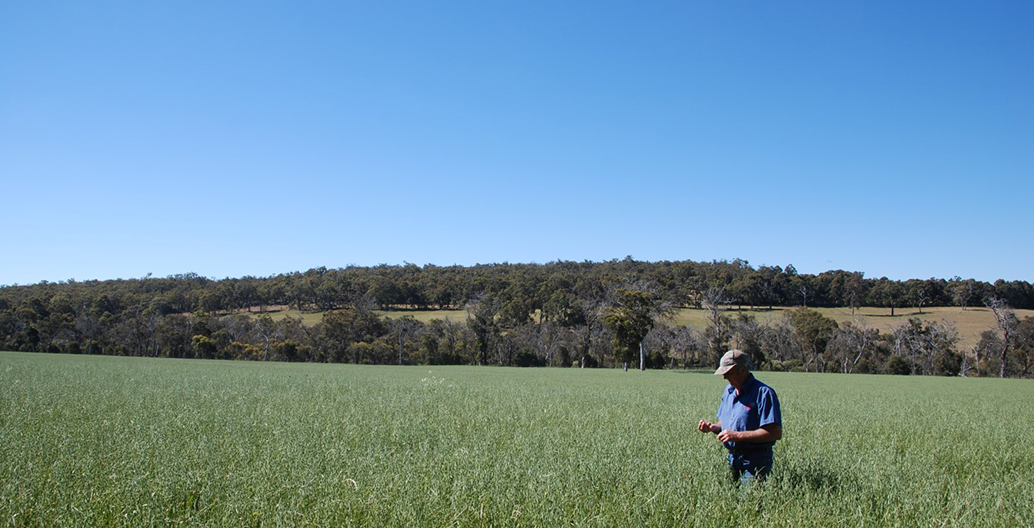
Ron Watkins on his organically managed farm, Payneham Vale Organics
I also looked into how uncontrolled farm traffic creates farmland compaction. Farm vehicles and machinery have varied wheel bases and spreads, the movements of which means that on average 85 percent of the paddock is compacted by wheel tracks each year. The compaction of soil reduces permeability for both water and the root structure of plants, which increases runoff while limiting growth. Controlled traffic farming (CTF) aims to divide paddocks into two sections: a healthy well-structured soil for promoting crop growth, and a track for supporting vehicles and machinery. By regulating the wheel base and spread of farm machinery, and with informed design and “deep ripping” to mechanically aerate soil, wheel compaction can be limited to 10 percent of the paddock. This can increase water penetration by 80 percent.
This research required an extensive review of literature and graphic mapping of the problems associated with the health of both the ecological and agricultural systems: an analytical approach that followed in the footsteps of Ian McHarg, who established the principles of geographic information systems almost half a century ago. It involved spatially mapping layers of information and ideas individually, then overlaying them to guide the design outcome. Through this process, several series of mapping data were generated to analyse the vegetation complex, hydrology, salinity, topography, geology and agricultural processes and practices. This was carried out at both the farm scale and within the Wongan-Ballidu region.
After analysing the local ecological and agricultural systems and processes separately, it became apparent that the degenerating health of farms and the associated environmental problems could not be viewed as separate entities. These processes are closely entwined, with water as the key element binding the future of farming in the Wheatbelt.
A deceptively simple conclusion emerged from this research: water needs to be kept high in the landscape. Keeping water high means to absorb rainfall before it becomes runoff, using the slope of the land to determine how the farming system operates. This includes redefining smaller paddocks that respond to topography and machinery dimensions, rather than surveyed boundaries on a map. By using revegetation belts to reconnect fragmented bushland along contour banks, these belts become shelter belts for native animals or livestock, while capturing runoff and providing a buffer for reducing evaporation and wind erosion. Keeping water high also allows deep rooted trees to soak up excess runoff and help lower the water table, mitigating the effects of salinity.
Such theoretical analysis, however, needed testing against a direct engagement with people on the land who have the same challenges and objectives. Farmers who are trialling alternative land management methods. Ron and Sue Watkins are organic broadacre farmers down in Frankland River. On visiting them, I realised that my research theories were already being practised.
Ecological restoration through agricultural design
The Watkins’ farm, Payneham Vale Organics, was my final stop along my Gondwana Link tour: a 1380-acre mixed livestock and cropping organic farm north west of Albany, which had been in Ron’s family since 1908. By the 1970s, however, the house dam started becoming saline. The Watkins decided it was time to move towards a more environmentally sustainable farming system. Since then, they have worked tirelessly to convert their traditional cropping and grazing farm into an organic, healthy ecosystem.
It is commonly assumed that organic farming doesn’t work on a broadacre scale. Yet this is broadacre organic farming that has been running sustainably for 20 years, with an impressive rotational system of cropping, cattle, sheep and chickens, each providing different benefits to the soil. The majority of their produce is sold locally at the Albany farmers market, while their organic hay is destined for the Japanese export market, where demand always outstrips supply.
It was during the transformation of his own farm that Ron developed an approach to holistic farm planning, surveying and re-designing farmland to take into account environmental factors such as water, wind, ecology, slope and aspect, optimising the use of each site to suit its own individual characteristics. His observation and mapping of water movement on the farm informed his approach to keeping water high in the landscape, with contour banks lined by shelter belts of trees capturing runoff, which is then directed into a series of tiered dams for use over the rest of the property.
As a farm, it is an exemplar for the aims of the Gondwana Link: to reconnect fragmented habitat, improve the health and resilience of the land and restore ecosystems back to a regenerative whole. It also proves that farming is possible within a healthy ecological system.
To begin to reverse the effects of land degradation in the Wheatbelt, we need a regional or catchment approach to revegetation, land use and ecosystem recovery. To apply these principles at a regional scale also requires a shared vision among farmers, communities and local government. What the Watkins have accomplished at Payneham Vale is a thriving example of the benefits that whole farm planning can bring to broadacre farmers in the Wheatbelt. Following the Watkins’ lead, we have an opportunity to achieve long term regional farming viability within this critical region for Australia’s agricultural economy, and its food security. Without action, on the other hand, we should expect the degradation and the devastation – of family farms, of rural communities, of ecologies – to continue.
Christie Stewart is a landscape architect at UDLA in Fremantle, Western Australia. A practising artist and apiarist in her spare time, she is inspired by the interwoven connectedness of Western Australian landscapes. With a background in farming and furniture making and a passion for sustainable agriculture, she will be continuing her investigation of regenerative farming systems with a Bachelor of Ecological Agricultural Systems at Charles Sturt University.
This report is written following the completion of a 2015 Hassell Travelling Scholarship, extending Stewart’s Honours thesis to an exploration of the Gondwana Link.