Perth’s second coast
Understanding and designing with Perth’s ‘second coast’ is key to the city’s future.
There’s an allure to Perth’s coastal edge. With some of the country’s best beaches, the city reclines toward the blinding blue-green water and stretches out for more than 150 kilometres along a continuously developed coastline. So intense is Perth’s orientation to the Indian Ocean that most of our drinking water is now drawn from it (and we also use it on the lawn).
A ‘second coast’ runs straight through the city – and extends deep below it. This is the tapestry of wetlands, streams and rivers that once covered the entire region. This rich hydrological landscape is as vital to the urban and environmental future of Perth as its ‘first’ coast.
The water contexts of the second coast have been ignored throughout Perth’s recent history, and continue to be today. These seasonal wetland-scapes are nuanced, and have been misunderstood historically. Cultivation began in haste after European settlement: wetlands were filled, routed through drainage channels and pipes, and converted to market gardens, ovals, parks, walled lakes, rubbish dumps and freeway forms. Much has been lost, but much remains, and the flows continue.
Perth is located on the clarified western edge of Australia, and this explains its hydrology and urban form. The Swan Coastal Plain, over which Perth stretches, is situated between the Indian Ocean and Darling Scarp, the topographical edge of what is known as the Yilgarn. The Yilgarn extends for nearly 1000 kilometres inland and is the most ancient landform in the world, eroded to its bare geological form. Below, a freshwater plain was formed in a geological blink, built up in layers by rivers and clays pouring down from the weathering Yilgarn and the Indian Ocean sands lapping over time.
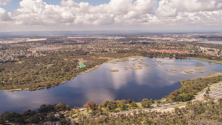
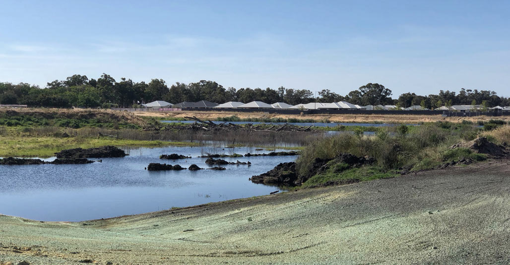
Bibra Lake, Western Australia. Image: BE Productions
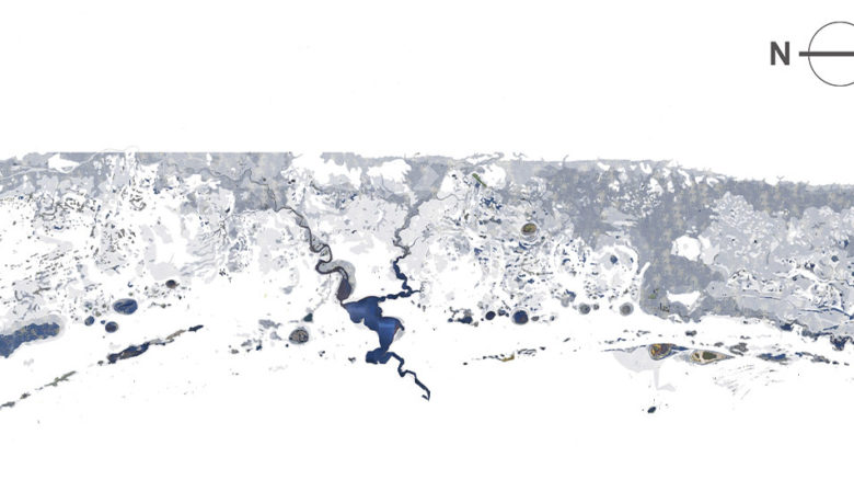
The historic wetland landscape of the Swan Coastal Plain, reconstructed from geological surveys & groundwater & terrain data.
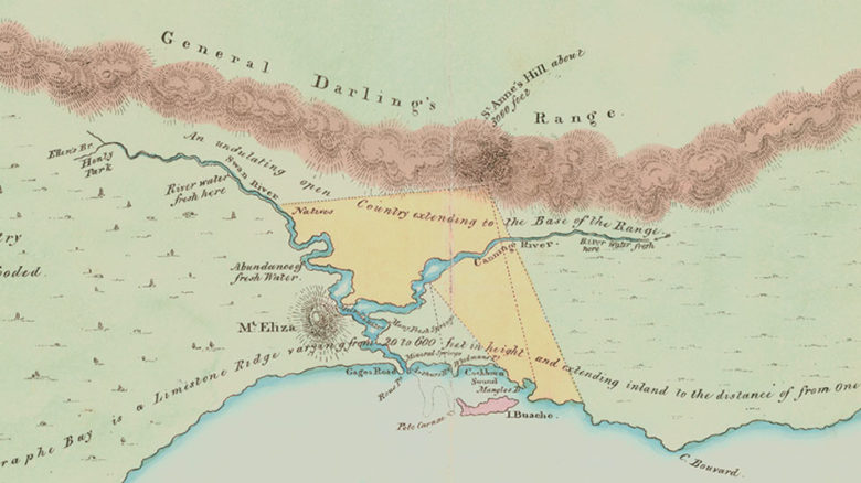
Stirling’s Chart of 1827 foregrounds the presence of freshwater across the Swan Coastal Plain.
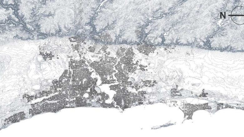
Perth’s urban area stretches along the Swan Coastal Plain between the Indian Ocean and the Yilgarn.
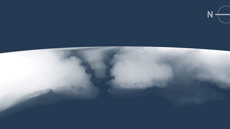
Superficial aquifers form groundwater mountains beneath the city: Gnangara Mound (north) & Jandakot Mound (south).
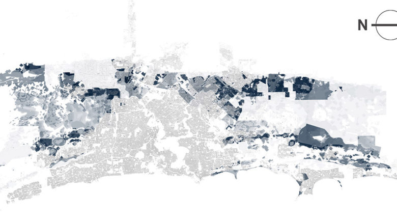
Overlap between clay & high groundwater intensities, & projected suburban development at Perth’s fringe (Adapted from Dept. Planning, Lands & Heritage, 2018).
The series of aquifers underlying Perth are unique to the Swan Coastal Plain: no other Australian city, and few cities globally, share it. It was only from the 1970s and ’80s that the extent of these groundwater structures was measured and the potential for urban use comprehended. Mountains of water beneath the ground are expressed on the surface as the lakes and wetlands that rise and fall with the groundwater seasonally, and with the moon monthly. These aquifer tiers (the superficial; the Leederville; and the deepest, the Yarragadee Aquifer) are held within layers of sands and trapped by layers of clays. The Yarragadee is many kilometres below the surface and hundreds of kilometres in length. The water stored in the Yarragadee is up to 40,000 years old, can reach temperatures of 95 degrees Celsius, and could hold around 2000 Sydney Harbours.
Perth was and remains a hydrologically intense city. But these hydrologies, and the aquifers, have been in decline. Groundwater has been tapped for scheme water supply, residential irrigation, public irrigation and for agricultural use. The sinking of private bores, which escalated from the ’80s, has drawn down the superficial aquifers; there are now nearly 200,000 regulated but unmonitored bores in backyards. Groundwater enabled Perth to maintain the most consumptive water culture in Australia and feel little compelled to change behaviour, despite a drying climate and growing population.
By the mid 2000s, desalination became necessary for Perth to maintain its levels of water consumption. In 2017, desalination accounted for 54 percent of Perth’s scheme water use (by far the highest level in Australia), and used up to 6 kilowatt hours of electricity per kilolitre, according to online publication Water Technology. (In 2005, before desalination, Perth’s average energy intensity for scheme water was, according to the 2008 CSIRO report Energy Use in the Provision and Consumption of Urban Water in Australia and New Zealand, a steady 0.56 kilowatt hours per kilolitre). Designing with local water cycles and systems in mind can significantly reduce dependencies on desalination and groundwater. In Adelaide, around 49 percent of houses are provided with significant water reserves through rainwater tanks (Australian Bureau of Statistics, SA Stats: Household Water Consumption and Conservation Actions, 2011); the city receives around 550 millimetres of rainfall annually, according to 2017 Bureau of Meteorology statistics. In Perth, according to recent ABS data, only 9 percent of houses are with tanks, but the city receives, on average and as cited by BOM, around 850 millimetres of rain per year. Household rainwater collection is one method of localising water supply. At the precinct scale, there have been proposals in Perth for stormwater recycling, collective rainwater harvesting, locally-managed aquifer recharge and abstraction, and water supply through ‘third pipe’ schemes. However, many of these innovations continue to face threats from the business-as-usual mentality.
Today, business-as-usual suburban development in Perth continues at the expense of sustainable water supply and consumption, as well as sensitive groundwater systems and wetland environments. Many of Perth’s water crises are crises of design.
Perth is a sandy city and this has enabled the easy development of the land. In the west, slabs and soakwells into sandy soils are commonplace. However, the Perth region is also covered in rich clay complexes with fertile ecologies, which are in need of different approaches. The claypan wetlands at Perth’s foothills are phenomenally biodiverse; some tiny remnants hold more than 500 unique species of flora. The scale of suburbanisation in clay-rich high groundwater areas has increased in recent decades. Perth faces a scenario where many of the ‘easy’, sandy, low groundwater areas are built upon, with the exception of Perth’s longest arm of ‘first coastal’ sprawl to the Alkimos dunes and beyond.
As a result, much suburban development will be going lower, closer to groundwater, onto clay-rich grounds, and into areas of ex-agricultural, hydrological and wetland intensity. This raises water-quality concerns around nutrients and flows to rivers and wetlands, and quantity concerns in terms of flooding and drainage. Perhaps worst of all, development in these areas is predicated on hydrological erasure. ‘Business as usual’ involves stripping remnant trees and vegetation and covering over existing water. It involves extensive siteworks, the dumping of sandy fill and the benching of the land. These are incredibly costly prerequisites to building in Perth, both financially and environmentally. The building culture and material economies of Perth demand clear-benched sandy sites as a prerequisite for concrete floor slabs, heavy double brick and tile construction, and soakwells and drainage.
How do we design a water-sensitive city on these hydrologically intense sites? Rather than erase water, how can we live with water as a vital element in urban life? Appropriate responses to these questions will lead to environmental conservation, sustainable water consumption and decreased irrigation, and bring other benefits in terms of wellbeing and microclimate. It will be necessary to shift ‘business as usual’ practices on the fringe while minimising fringe development by encouraging quality medium-density housing within existing urban areas. Increasing density can dramatically increase the water sensitivity of the city. Well-designed infill developments in Perth can begin to recover hydrologies, build with the groundwater conditions and bring water presence to our urban environments.
The shift begins with an awareness of the water contexts and persisting richness on which Perth is grounded, and an acknowledgment of the role and responsibility of those in control of architecture and housing.
Daniel Jan Martin is a PhD candidate in the School of Design and Humanities, The University of Western Australia and research officer at the Cooperative Research Centre for Water Sensitive Cities. (CRCWSC)
Geoffrey London is Professor of Architecture at The University of Western Australia and a Professorial Fellow at The University of Melbourne. He previously held the positions of Victorian Government Architect (2008-14) and Western Australian Government Architect (2004-8).
This article was originally published in Future West (Australian Urbanism). It is drawn from a research and mapping project at the CRCWSC, led by Nigel Bertram and involving The University of Western Australia, Monash University and The University of Queensland. This research will culminate in a book to be published late 2018.