A matter of time: Design in the age of sea level rise
In the past two decades factors leading to rising sea levels have increased by 50 percent, with serious consequences for our cities and how we plan and design them.
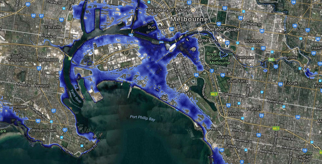
The launch of an online hazard-mapping tool Coastal Risk Australia recently grabbed the public’s attention, as it provides a worrying picture of how sea level rise might affect many of Australia’s capital cities. The tool, which can project inundation scenarios through to the year 2100, was created to inspire the public, urban planners, local government authorities, insurers and other organisations to find out more about local flood risk and take action.
The Cooperative Research Centre for Spatial Information (CRCSI) and NGIS, an Australian spatial mapping company, have used data collected with airborne LiDAR technology, a surveying method that measures distance with laser light, to generate 3D digital elevation models of the Australian coastline. They combined these with the latest tide and sea level rise projections to create inundation maps, so that users can see which areas of cities and towns are most at risk under a two to 2.7-metre sea level rise, which is now a “plausible worst-case global mean sea level rise scenario“, according to US National Oceanic and Atmospheric Association (NOAA). While the tool employs the relatively simple “bathtub method” of modelling inundation, the results are shocking.
Low-lying coastal cities such as Cairns and Port Douglas show immense areas of inundation to their CBD’s within the lifetime of the next generation. Several politicians shrugged off the threat. To Mayor Bob Manning, this projection was “wild or outlandish”. It just didn’t look like the maps he’d seen before.
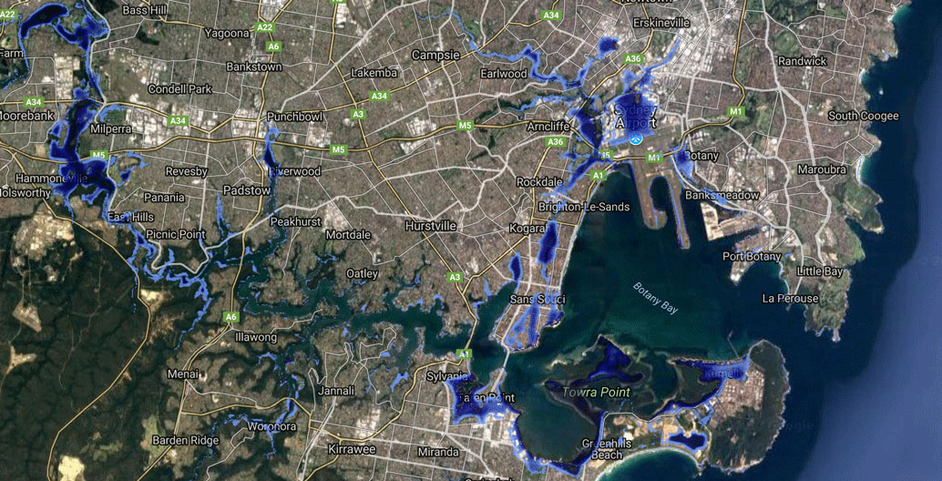
Greater Sydney's projected sea level rise by 2100. Image: Coastal Risk Australia.
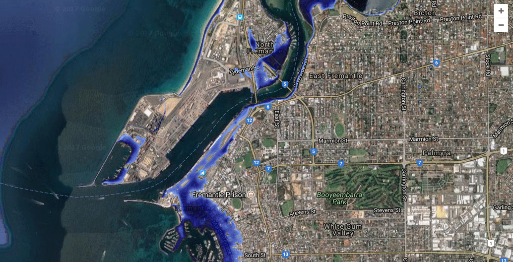
Fremantle's projected sea level rise by 2100. Image: Coastal Risk Australia.
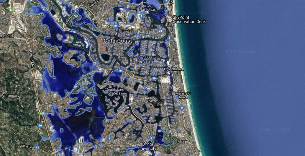
The Gold Coast's projected sea level rise by 2100. Image: Coastal Risk Australia.
A tale of two projections
It’s possible that the Mayor of Cairns has been looking at another comprehensive hazard tool called CoastAdapt. It was released a year earlier by the Queensland- based National Climate Change Adaptation Research Facility (NCCARF). This earlier hazard tool has been widely adopted by councils, providing planners with greater detail than Coastal Risk Australia. Present day flood risk maps include local government boundaries, geology (providing information on the erodibility of the coastline), and physical risks (e.g. ocean currents, geomorphology). Importantly, it is more complex than Coastal Risk Australia because it reflects an understanding that coastal flooding is caused by the interaction of storm surges and waves with other factors such as seabed bathymetry (measuring seabed water depth) and the coastal landscape. To accomplish this, a single, consistent map of coastal landforms for the entire Australian coast was built.
Like Coastal Risk Australia, the CoastAdapt site supplies future scenario maps up to the year 2100 for every coastal local council in Australia. But whereas Coastal Risk Australia uses very recent sea level rise data, CoastAdapt uses 2013 data from the Intergovernmental Panel on Climate Change (IPCC). Using this data, CoastAdapt’s first pass assessment projected a sea level rise of up to 1.1 metre by 2100, a considerably less apocalyptic scenario than the updated worst case scenario of a 2.7-metre rise. Local councils and their planners are therefore commonly using an outdated projected sea level rise of 1.1 metre.
So why do these two vital sources of information differ so much, given both address the same issue, both are using modelling supplied by the same Cooperative Research Centre for Spatial Information and the two were built within a short period of each other? Digging into CoastAdapt supporting notes, there is a significant caveat to the accuracy of their projections: “It is important to remember that surprises can occur, and there is a low but not zero probability (and with high consequences) that sea-level rise will exceed the estimates provided here.”
What a difference time makes…
The UNSW Climate Change Research Centre’s Professor John Church, described by climate science colleagues as the “Bradman of sea level science”, was a key scientist who worked on CoastAdapt. This month a team he was part of released a new article on sea level in the important scientific journal Nature Climate Change. It shows that observed sea-level rise increased by a surprising 20 percent in the past two decades. The melting of the Greenland ice sheet has contributed most of this rate of rise, as the result of water added to the ocean from both surface melting of the ice sheet and the flow of ice into the ocean. They politely conclude that it is now time to start formulating coastal adaptation plans: the scientific equivalent of a siren.
At this point it should be noted that about 125,000 years ago, sea levels were five to ten metres higher than they are now, at temperatures not much warmer than today.
To summarise this tale of two projections, In making their critical coastal planning decisions, many local councils depend on CoastAdapt – but its data is now out of date. Meanwhile, Coastal Risk Australia, using new projections from Greenland and Antarctica provides both more dramatic and more accurate projections.
It is noteworthy that NCCARF, which produced CoastAdapt, had its funding axed in the recent federal budget. In 2017, it will share $600,000 with CSIRO to keep its online platform going. By 2018, this funding will disappear entirely. A scary and dumbfounding decision at a time of rapid change. Where this leaves local councils and others who need to understand the likely impacts of sea level rise across Australia is anyone’s guess.
Making your sea level rise: First take 408.65 ppm of carbon dioxide
So why are oceans changing so rapidly? On 27 June 2017, the carbon dioxide in the atmosphere was 408.65 parts per million (ppm). The last time carbon dioxide was greater than 400 ppm was three million years ago in the Pliocene. At that time, the temperature was three degrees celsius warmer, sea levels were 20 metres higher and Antarctica had insects, mosses and alpine southern beech trees growing along the flanks of the Transantarctic Mountains. Our Earth is now trying to catch up to this new Pliocene-like atmosphere, with the warming atmosphere having a destabilising influence on the oceans.
The volume of water in the oceans changes dramatically depending on whether the planet is hot or cold, with two things primarily contributing to that change. When the ocean heats up, it expands due to the thermal expansion of water. This effect contributes to about half of the current sea level rise. The current warming effect on the oceans is higher than at any time over the last 800,000 years, according to a recently completed University Melbourne and CSIRO study.
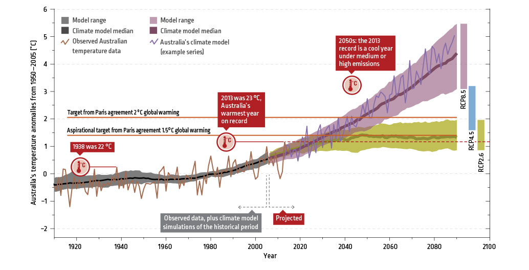
The CSIRO's projections of Australian temperatures by 2100. Image: CSIRO
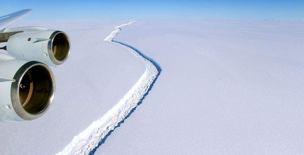
Larsen C finally broke off from West Antarctica 12 July image: NASA
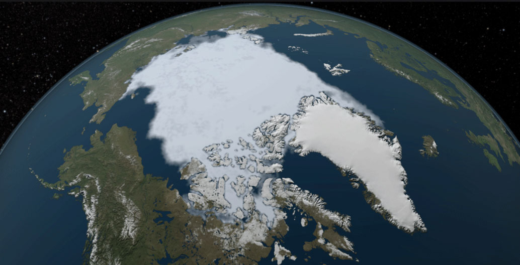
The arctic ice sheet in 1984. Image: NASA.
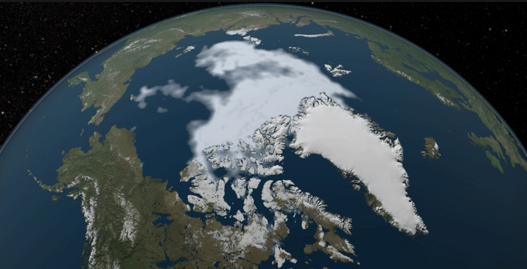
The arctic ice sheet in 2012. Image: NASA.
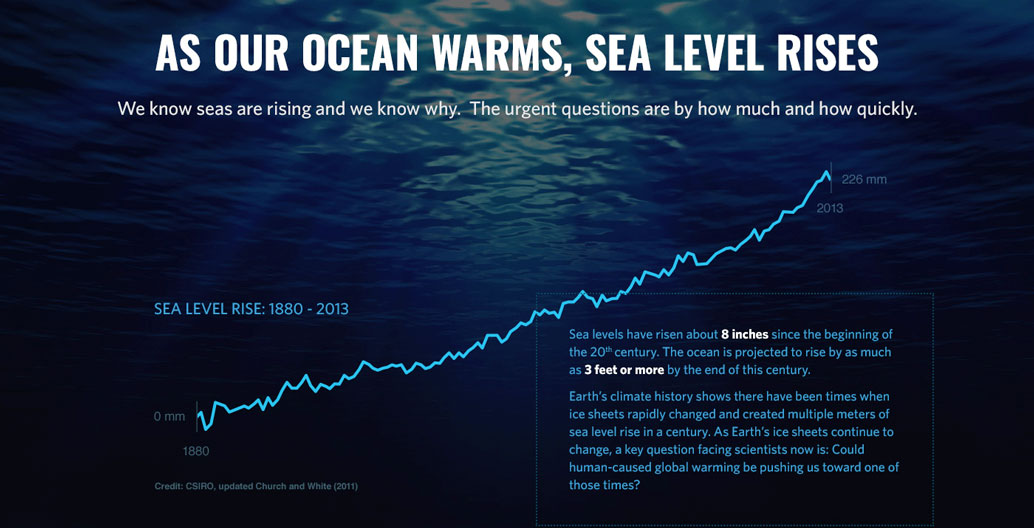
Global sea level rise between 1880 and 2013. Image: NASA.
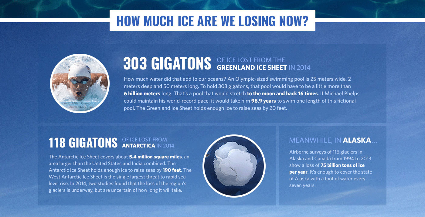
The loss of Greenland ice sheets alone has added 303 gigatons to our oceans. Image: NASA
The second contribution to rising sea level is the melting of the vast polar ice sheets and glaciers. The future of all coastal land on Earth depends on how much and how fast polar ice sheets melt. This is not hyperbole. Just three closely watched glaciers, Thwaites, Jakobshavn and Zachariae Isstrom, would contribute more than two metres to global sea level if they were to melt fully.
Not surprisingly, scientists have been spending a lot of time studying one of Earth’s climate engines: the Antarctic continent and the surrounding Southern Ocean. Their common task is to understand ice sheet dynamics. Just as we have seen in the northern polar regions around Greenland, southern ice sheets are melting rapidly.
The disintegration of the Larsen Ice Shelf on the Antarctic peninsula has been unusual. In 1995, the 4,000-year-old Larsen A ice shelf collapsed. This was soon followed by the dramatic breakup of the 10,000-year-old Larsen B ice shelf in 2002. On 12 July 2017, the Larsen C ice shelf in West Antarctica shed a gargantuan iceberg of roughly 6000 square kilometres, an area more than twice the size of the Australian Capital Territory. Scientists fear that the loss of this portion of the ice shelf, which is one of the largest icebergs on record, could lead to the future collapse of the rest of the ice shelf and thereby cause landward glaciers to accelerate their flow into the ocean and subsequently raise sea level. Such volatile accelerations in glacial melting are what make climate predictions subject to constant reassessment.
Notwithstanding uncertain future predictions, our confidence in measuring present day sea level change is increasing. Modern NASA satellite data shows us clearly that the loss of land ice mass has accelerated since 2009, in both Antarctica and Greenland. Sea level data is also getting better. Satellites now complete a global mapping of sea surface height once every 10 days and use radar altimetry sensors to measure sea surface height accurately to within 3.3 centimetres.
Sea level rise and cities: What’s to be done?
How do you design for a hazard that changes with time? The short answer is we need to adapt our policies to new information as it’s received. Yet, for example, the Victorian planning policy framework requires planning for a sea level rise of not less than 0.8 metres by 2100 (based on the Victorian Coastal Strategy), well below the worst case figures informed by science today – and these could well be revised upwards again soon. State governments are responsible for responding to sea level rise impacts with strategies, policies and legislation. Their responses to the changing nature of this hazard will have a profound impact on the level of adaptation response seen at a local level.
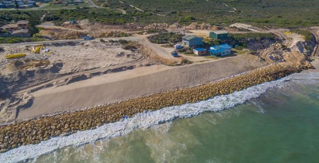
"In the mind of the public if you want to hold back the sea you use a wall". Seabird seawall, WA. Image: Neo infrastructure
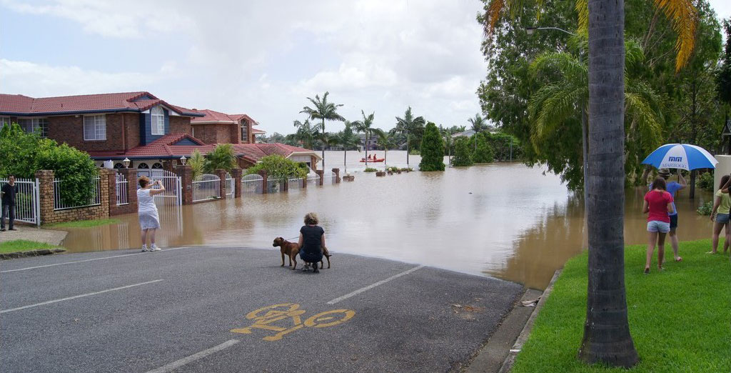
Floods in Australian cities are becoming increasingly frequent and dramatic. Image: Australian Department of Defence.
Traditionally, government responses have addressed only one fundamental question “whether to retreat or hold back the sea”. Not surprisingly, in the mind of the public if you want to hold back the sea you use a wall. That is just what the residents of Seabird in Western Australia recently demanded of their council, when fierce winter storms caused coastal erosion that threatened their properties. Sea walls are an effective defense against energy that can damage infrastructure. However, the energy sea walls reflect often interferes with the coastal processes that occur around them. Their artificial hard shoreline can prevent sediment from reaching further alongshore. Professor Charitha Pattiaratchi, head of the UWA’s School of Environmental Systems Engineering, argued Seabird’s wall, erected in panic, is likely to cause erosion problems further along the coast. They can also form a barrier to the natural response of coastal ecosystems, such as mangroves or tidal marsh, to move landward during sea level rise.
Kristina Hill, an associate professor in landscape architecture, environmental planning and urban design at UC Berkeley, thinks there could be other alternatives. She has extensive experience in adapting urban districts and coastlines to sea level rise. Her background in ecology and geomorphology helps prepare her for her collaboration with Dutch teams to develop responsive designs to help protect coastal communities. She has investigated the limits of adaptation, and is currently working on a book to investigate how urban waterfronts could be adapted to sea level rise while incorporating productive ecosystems.
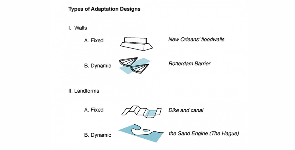
Talking about urban areas, Hill attributes flooding to a squeeze from four directions by “local rain, together with rain fed down by rivers, sea level rise and groundwater rise. ….. Just thinking about sea level is a mistake.” According to Hill, there have been three ways of adapting to this squeeze in the past: moving development away from shore, raising development or protecting coastal zones with fixed flood walls, wetlands or pumps.
Instead of protecting coastlines with fixed infrastructure, she argues that we should be investigating adaptive infrastructure. “The economic goal of building adaptive infrastructure is to make every infrastructure dollar do more work by insisting on multi-functionality,” she says. “Pipes, walls, and bridges need to be transformed into structural scaffolds with multiple benefits. These scaffolds can be designed to interact with self-organizing systems of plants, animals, and cultural behaviors to create more benefits for society. For human rights reasons, setting functional priorities for these systems must include creating benefits for human aesthetic experience and quality of life.” This type of approach, incorporating flexibility in response over time, echoes the new thinking that is evolving in climate change adaptation policy spheres.
Landscape architects such as Kristina Hill believe we need to be designing adaptive landscapes.
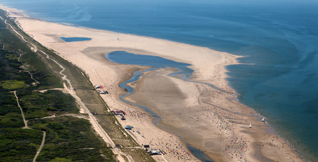
A Dutch 'sand engine', or 'Zandmotor'.
Dutch 'sand engine'. Image: Netherlands Government.
Cyborg landscape – a hybrid of machine and landscape. Image: Netherlands Government.
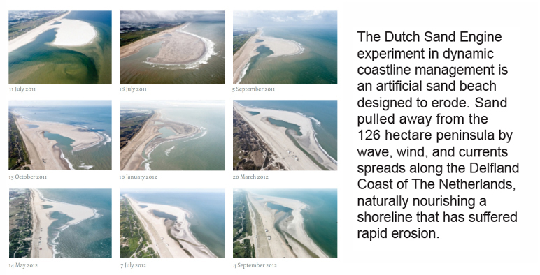
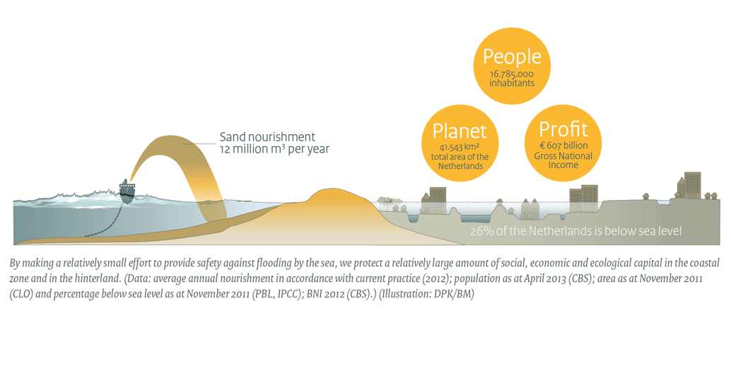
She therefore sees landscape as a flexible, living coastal infrastructure that can be designed and can support ecosystems, while also absorbing the energy of waves and floods. A good example of dynamic adaptive infrastructure is the seven-year-old Dutch “sand engine” experiment, which she describes as a cyborg landscape – a hybrid of machine and landscape. It is conceived using “building with nature” thinking that takes advantage of natural dynamics, such as longshore drift, to build a widened beach that protects the Netherlands against the sea. For Hill, such responses to sea level rise will not only change cities but will also change the “design practices that engage and operate in urban space”.
Landscape architect Nate Kauffman agrees. In a design for San Francisco bay called the Live Edge Adaptation Project, he envisaged the large-scale construction of offshore landforms that would act as barrier islands to the city. These barriers would absorb wave energy and would slowly develop tidal marshes behind them. He thinks “we should see the challenge of sea level rise as a design opportunity, because it is a major opportunity for us to rethink how we live”.
Such rethinking is urgent in low-lying coastal suburbs, such as those that hug the edge of Melbourne’s Port Philip Bay. A recent research project conducted by the Co-operative Research Centre for Water Sensitive Cities, led by Nigel Bertram, Catherine Murphy and Rutger Pasman, took as its research site the flood-prone suburb of Elwood. Once the site of a swamp that was drained into Elwood Canal, Elwood is located at the bottom of Elster Creek Catchment, an area covering approximately 40 square kilometres of Melbourne’s inner south eastern suburbs.
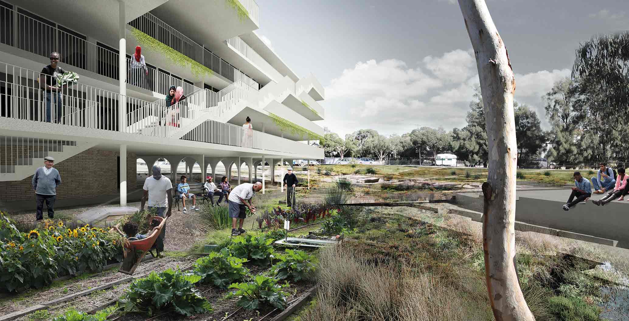
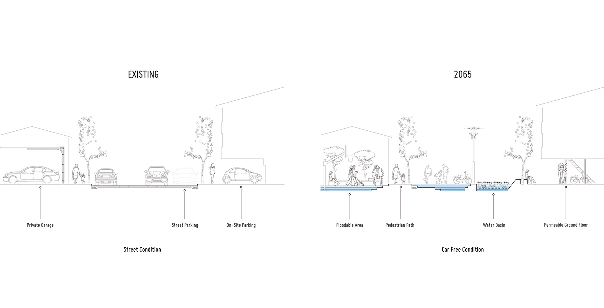
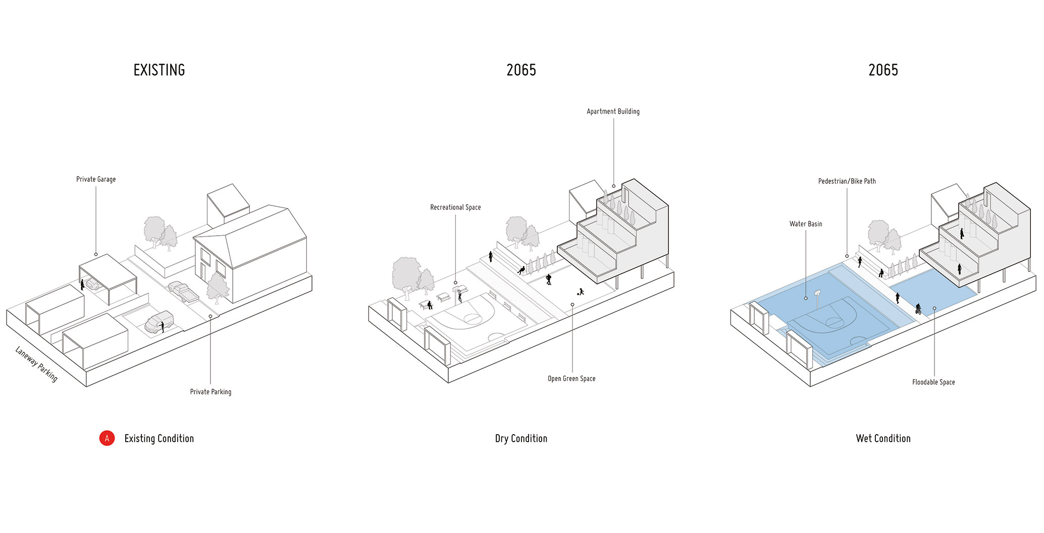
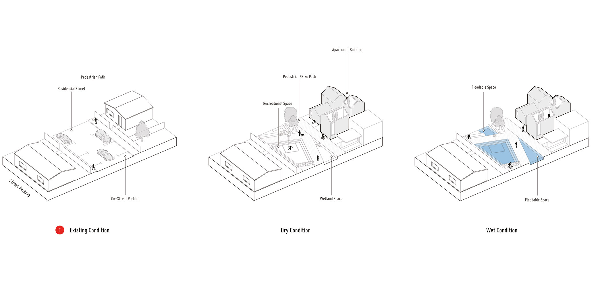
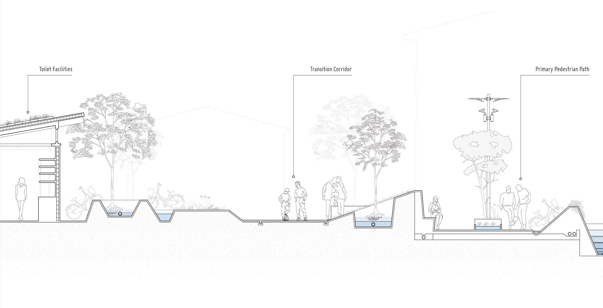
Their research, which resulted in an exhibition and publication in 2016, proposed several measures to help plan for and respond to the likely impacts of inundation. Interestingly, many of the proposals were not billion-dollar land forming exercises, but responses at the scale of a precinct or neighbourhood. They took the idea of adapting landscapes over time and applied the same long-term thinking to what is otherwise often the relatively short-term projections of urban planning. In doing so, the research proposed the incremental introduction of water-responsive landscape interventions that could lead to a 2065 scenario where Elwood becomes a “thriving water sensitive suburb”.
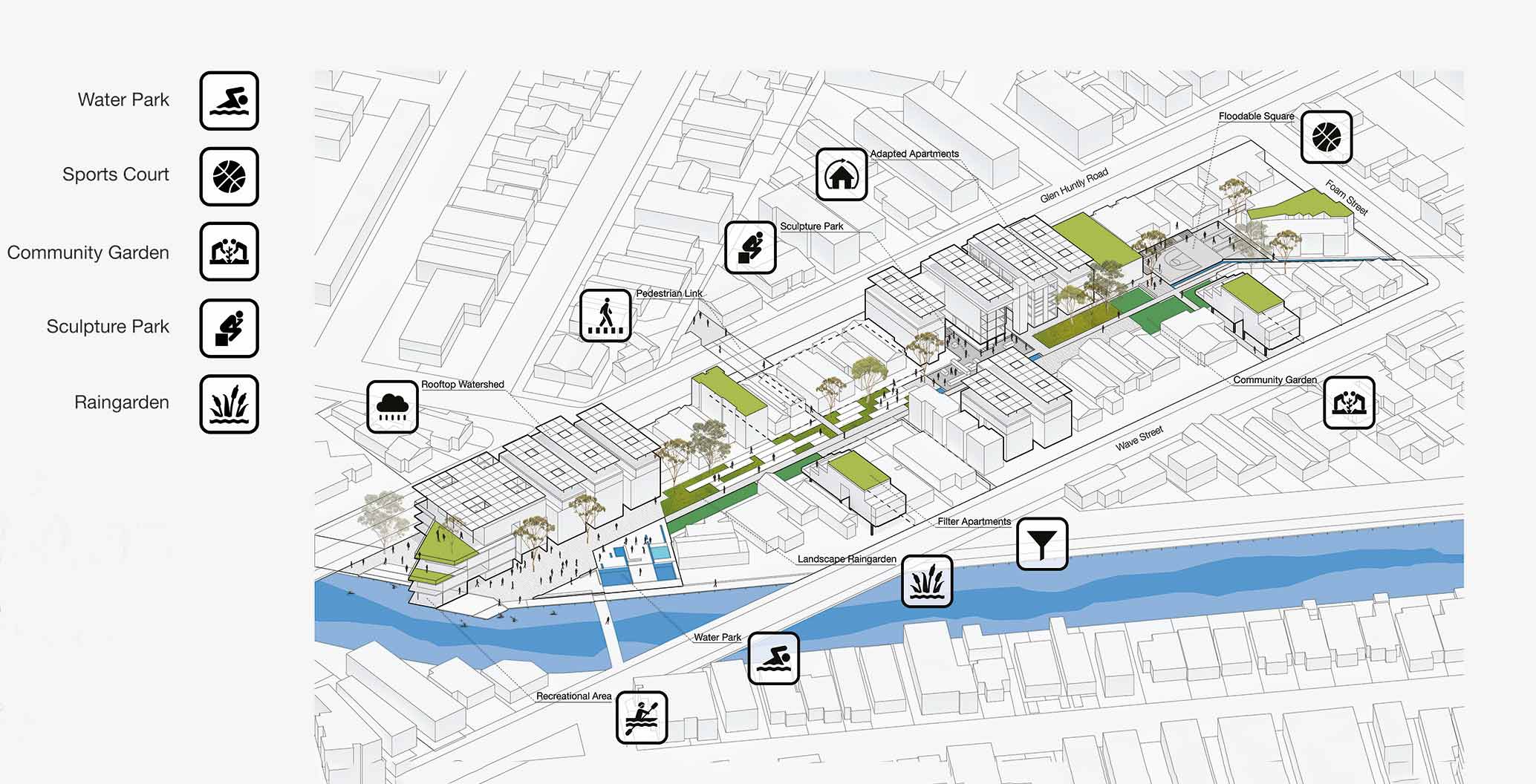
Incremental introduction of water-responsive landscape interventions proposed by the CRC for Water Sensitive Cities.
Incremental introduction of water-responsive landscape interventions proposed by the CRC for Water Sensitive Cities.
Incremental introduction of water-responsive landscape interventions proposed by the CRC for Water Sensitive Cities.
Incremental introduction of water-responsive landscape interventions proposed by the CRC for Water Sensitive Cities.
Incremental introduction of water-responsive landscape interventions proposed by the CRC for Water Sensitive Cities.
Incremental introduction of water-responsive landscape interventions proposed by the CRC for Water Sensitive Cities.
By this time, it envisages the creation of “water body corporate” entities, of 10-20 adjacent private allotments. These entities could share precinct-based responsibility and own risk for site-level water collection, retention and diversion works. These modestly scaled endeavours could establish raised walkways and small scale wetlands and floodable areas. Scaled up, the approach could develop into a catchment-wide network of public open spaces, to increase flood retention capacity and mediate the impact of storm surges on the inner wetland environment.
The research project also explored options to convert apartment buildings (representing close to 75 percent of Elwood’s housing stock), by removing the ground level dwellings and adding an extra floor on top. Here, the primary challenge is simply one of amending the planning code to increase allowable height.
Taken together, these examples all seem to recognise the need for new answers, be they based in adaptive infrastructure or new conceptions of the suburban landscape. Certainly, recent efforts to mitigate flooding using conventional means have proven expensive, ephemeral and arguably unsuccessful. New York has just completed a new boardwalk south of Queens at Rockaway Beach, where eight people lost their lives in the climate change amplified storm surge of Hurricane Sandy. A new concrete walk, retaining wall and sand dunes cost US$375 million. Of that eye-watering total, the dunes alone cost a staggering US$35 million to build and it is more than likely that they could be washed away in the next supercharged storm. The city is also taking the time to relocate electrical infrastructure from flood-prone basements to high within its skyscrapers.
New York is now taking planning for storm surges more seriously. It has become the first state in America to release an official sea level rise projection regulation. This official projection will change as sea level science changes and will help agencies and communities plan and adapt.
While the uncertainty and acceleration of sea level rise should be a matter of concern for all the world’s citizens, it has a special resonance here in Australia. Unlike the dynamic coastlines of New Zealand or Japan, Australia’s coastal zone has remained relatively stable for thousands of years since the last glacial maximum (when Tasmania was connected to the mainland). The cities that lie along its edge have been developed with the confident expectation that stability would continue and sea level events would occur within an easily anticipated historical range. That period of stability is over.
The Australian Institute of Landscape Architects (AILA) has recognised the urgent need for adaptation and has released a position statement entitled “Adaptation to the Changing Climate – Building Resilience” this year. AILA recognises the complex multi-disciplinary approach that is needed and urges landscape architects to help government, businesses, and communities mitigate and manage climate change risks and adapt to the consequences of climate change. You can read the full full statement here.
There is a call for submissions by 21 July 2017 to a Senate enquiry into Current and future impacts of climate change on housing, buildings and infrastructure.
If you’re thirsty for more on this subject Nature.com has released this article.
Michelle Grosser is a science historian, writer and geologist.
[This article was modified from the original on 12 July 2017 to account for the partial collapse of the Larsen C ice shelf and again on 17 July to rephrase a more accurate lead paragraph]